
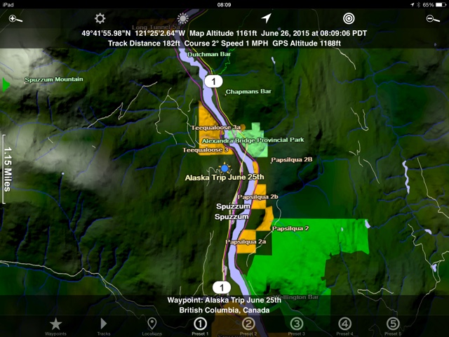
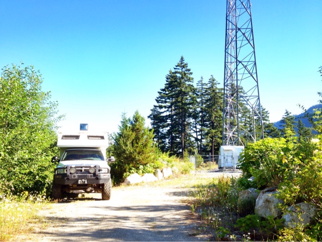
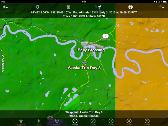
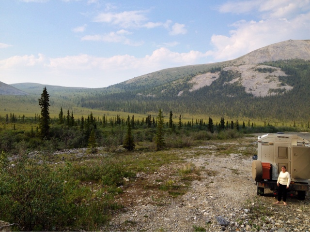
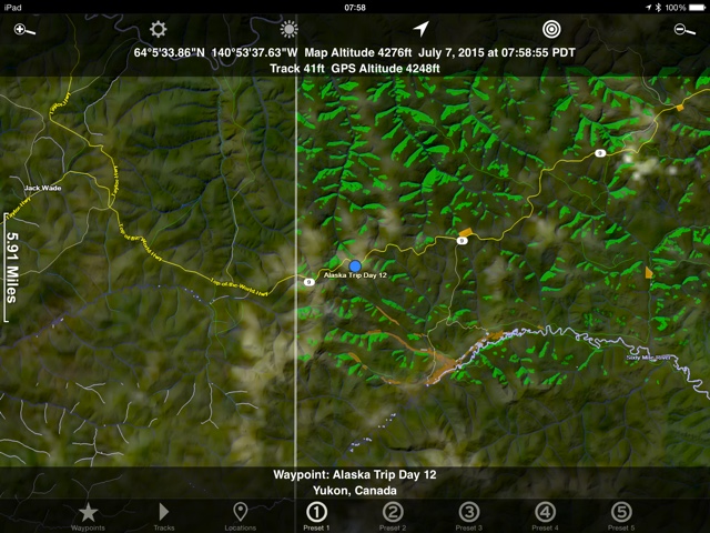
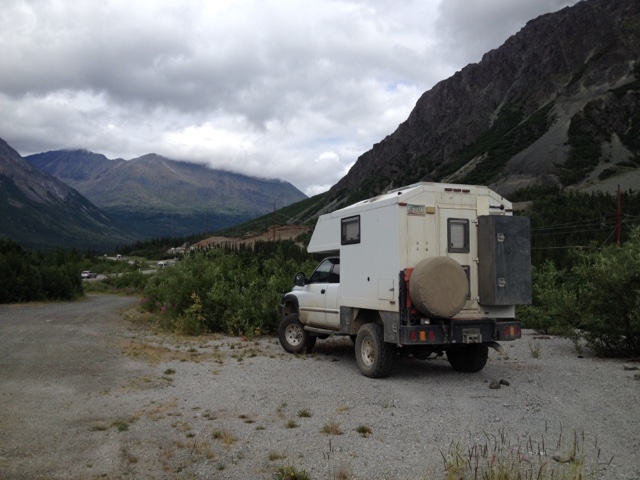
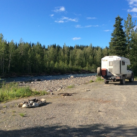
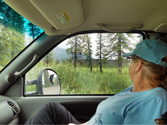
First a little bit about Alaska and why. I had the good fortune to work in Alaska many moons ago and used to fly into Juneau. I also flew to Fairbanks once in a private plane. So I’d been to Alaska, but never driven there. Having read many a blog about the adventure of seeing it for oneself I put it on my list of to do’s. When this trip was originally planned my girlfriend and brother were both talking about joining me. My mother and her boyfriend were also planning on driving their own vehicle down and we would meet up and cross paths several times. Well, as often happens, things changed. No girlfriend, no brother, and Mom’s RV wasn’t up for the trip. So Mom calls me and says “I hear you are going by yourself now”? Yes I am. “I’d still love to go you know and I would go with you for a day or a month”. And so it just worked out that way. I’m now traveling around northern Canada and Alaska with my 74 year old mother. Aaaand, we are having a blast. Mostly. I also need to say a word about Mosquitos. Yes, I’m a baby, I admit it. I can’t stand mosquitos. If I know there is one in the camper I’ll stay awake and find it before going back to sleep. I thought it would be fun to catalog the mosquito battle. I haven’t seen that done yet. The kills and bites are combined but usually Mom sleeps peacefully under the blankets while I jump around the camper with a flashlight and a tennis racket type zapper. I rarely use bug spray unless I plan on being out for a long time. In one trip to the outhouse I killed 8 of the buggers in the time it took to pee. After a week we figured out two things. The zapper only stuns them and they can get around my seitz window screens. It was a big surprise when I shook a couple bodies out of the racket onto the white counter and a few minutes later they took to the air again. A word about money. Early retirement has forced me to a watch my money. Ok, I can be cheap sometimes. Wait, lets call it frugal. I’m also logging what money is spent on the trip so folks can get an idea of what the trip could cost if you don’t eat out or stay in RV parks much. The exploremoremobile has been getting 16mpg for most of the journey. Lastly, I thought it might be fun for some if I show where we camped every night. I’ll take a screenshot of my ipad app, Scenic Map (highly recommended, not affiliated). It will show a basic look at where we are and for those that care gps coordinates too. That’s enough blah blah for now. Onto day 1. Alaska Trip Day 1 Cost 130 Canadian Groceries Mosquito wars, 2 kills and 2 bites June 25th Left my daughters house in Surrey, BC. at 11am. Stopped in Hope for groceries then headed North towards Prince George. Camped by a microwave tower for the evening. No view, 85 degrees at 5pm but cooled down to 62 at night for pleasant sleeping. We stopped early this day and slept late. Tired from visiting my kids for a week.
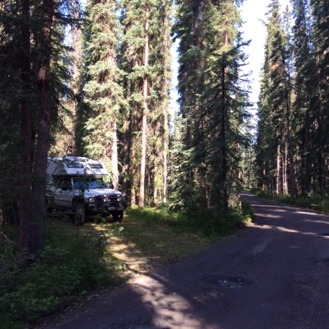
Camp site
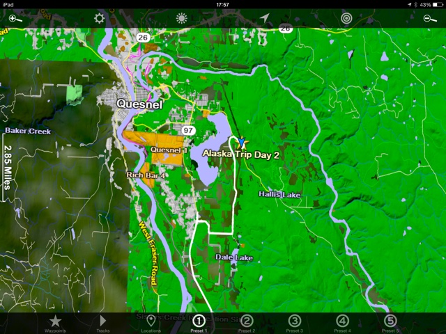
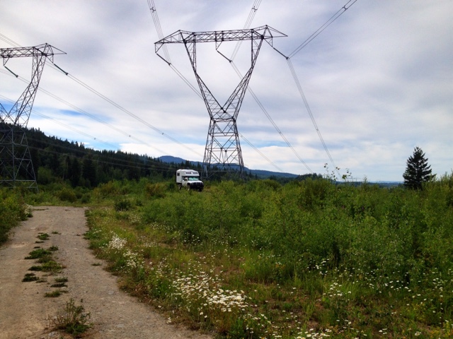
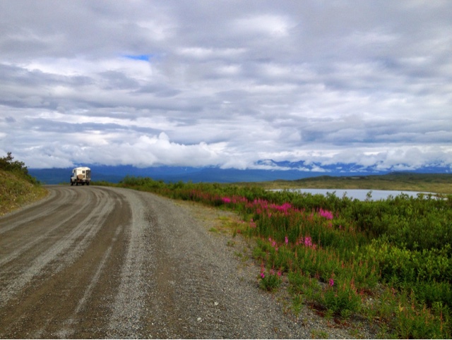
Day 2 Cost 70 Canadian for Gas. Got 16mpg Mosquito Wars, 4 bites, 42 kills. Slept in, hit the road around 9ish. Drove to 108 mile rest area for lunch and looked around the heritage site some. Cool old buildings and history but nothing really worth writing about. Drove a few more hours and checked pricing in a campground. It was 16 dollars Canadian for a level spot with no hookups, bathroom, and pay shower. We opted to cross the road and stay at the rest area. Settled in and then read that it’s illegal to overnight in a rest area. Closed the truck back up and moved down the road. Found government land in green color on ipad Scenic Map and looked for a place to camp. Ended up under powerlines outside of Quesnel. I was sitting outside planning more of the journey and route until I went in for dinner. Soon after I went in the mosquitos showed up. I had an awful night chasing mosquitos inside the camper. I was bit 4 times and killed 39 of the critters. Finally closed up all the windows and got to sleep fully at 2:30am. Camp Map
Campsite
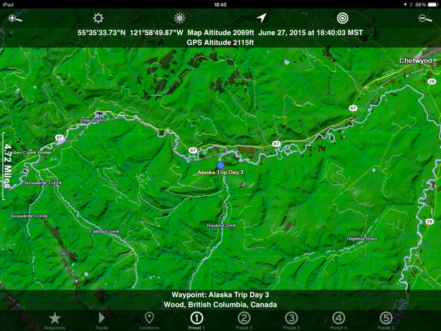
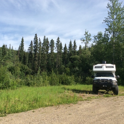
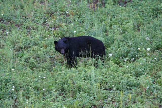
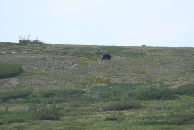
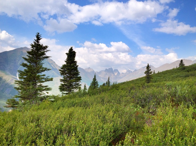
Glamorous huh. Day 3 Cost 66 Canadian Mosquito Wars, 2 bites and 7 kills Drove to the visitors center in Quesnel. Found out that recreation sites are free camping. Luckily Scenic Map shows them as light green on the map. They had a small museum next to the visitors center that we were thinking of seeing. After peeking in it looked sort of cheesy so we opted to head North towards Prince George. We found a recreation area to scout out for lunch break. It ended up being a trailhead only. It did however lead us to a nice spot by a lake to make some grilled cheese sandwiches for lunch. Heading North again the terrain finally started to get nice. Now seeing some mountain snow and waterfalls. Saw two bald eagles flapping around and then saw a black bear off the road a bit. After another hour of driving I saw a moose in the middle of a small lake with a black bear just entering the water. The bear looked like he had bad intentions. I only caught a glimpse while driving by. I almost used my tourist status to stop in the middle of the road and watch but it was too dangerous. After driving another two miles with nowhere to turn around and people on my butt we gave up knowing the action was probably already over and there wasn’t a safe place to stop anyway. Our campsites are getting better. Now we just fire up the ipad map and look for a road in the green area which is the “crown” land. We are now parked near a creek that we can only hear. I would explore it more but the mosquitos are here early and already bouncing off the screens. We are hoping we figured out where they got in last night and so far only one got in. Some solid sleep tonight would be nice.
Campsite

Yep, just looking at this campsite you can see it’s going to be a bug disaster.
No such luck on sleeping on night number 3. Tried to close window screen gaps with paper towels but they found their way in. Another night of waking every half hour to a facial assualt. The high temps are still in the mid 80’s. We are hoping for cooler temps and less bugs as we go north.
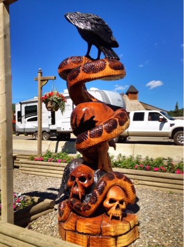
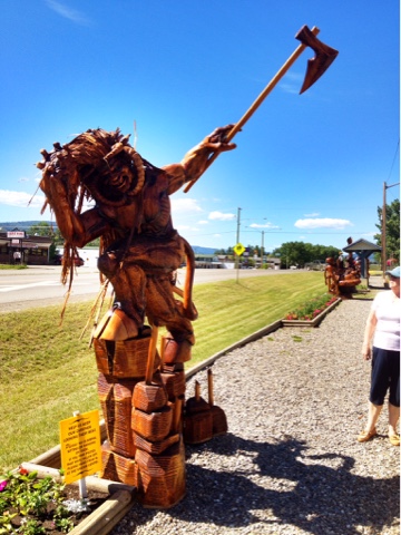
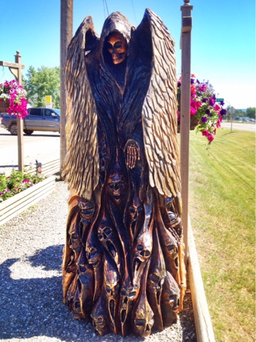
The day started with a short visit to Chetwynd and the wood carvings. Chetwynd is home to the international chainsaw carving championships. The town has over a hundred carvings on display from previous years. Some of them are downright incredible and worth seeing.
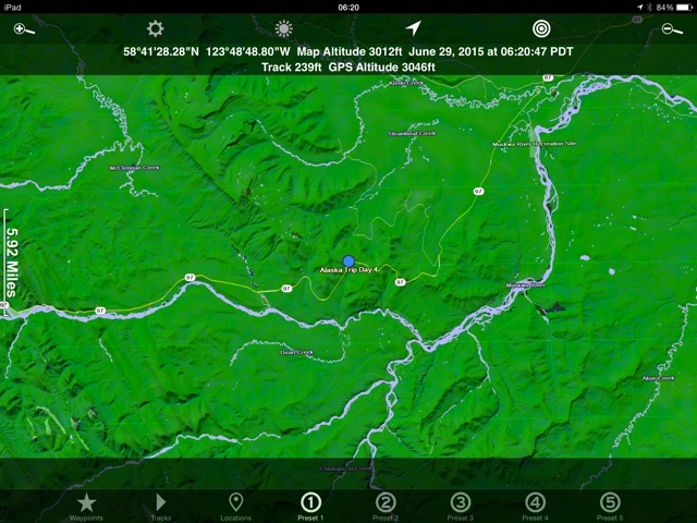
We made day 4 a driving day. Need to get a few more miles in if we ever want to make it to this Alaska place. Had lunch in a rest area. Opted to skip Dawson Creek and Ft. St. John. About 75 miles in to the Alaskan Highway it’s finally starting to look good. Less traffic, less population, more scenery and wildlife. Got fuel in Ft Nelson and drove another 25 miles or so. Decided on another mosquito strategy. Maybe if we stop at a relatively high altitude they won’t be as bad. Success, last night only 1 bite and 1 kill.
Where we were last night.
Campsite
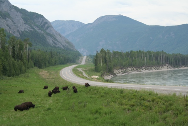
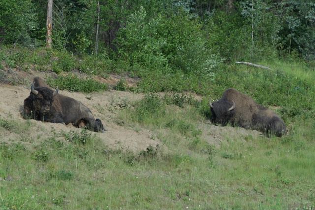
Day 5 Cost 0 Mosquito Wars, 2 bites and 5 kills. Getting better Finally caught up on some sleep. Only a couple of mosquitos last night. We slept in again and after a hearty breakfast of eggs and toast. Got on the road at 11am. I know, slackers, but hey if it’s not fun and relaxing then why do it. The plan for the day was to check out Monroe lake which is known as the most popular RV camping on the Alaskan Highway. We blew right by without even slowing. Saw them packed in like sardines and floored it. Next plan was to join the sardines at Laird Hot Springs. We would have stayed at this one but it was already full at 2pm. Onward to find a good place for a late lunch. Within an hour a buffalo heard presented itself on the side of the road for our lunch viewing pleasure.
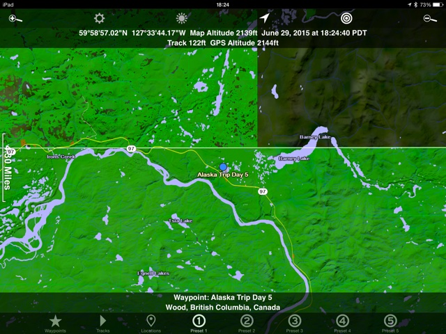
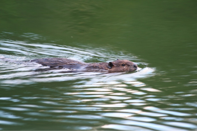
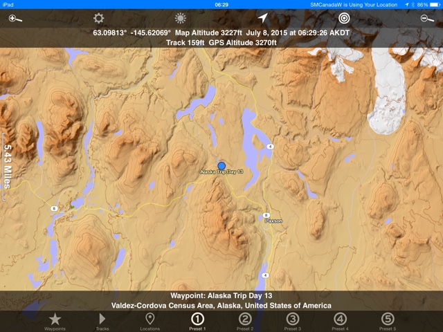
Tomorrows big plan is to check out the town of Watson Lake so a close to town camping area was found. We are currently sitting by a nice lake about a half mile off of the Highway. It’s raining for the first time since I left Hood River, OR. back in mid June. The temperature is coming down from 75 degrees with the rain and it feels wonderful. The high today was only 82, not hot, but still surprising to us how warm it is. I stood in the lake contemplating a brisk swim until I saw the leeches prowling around my toes. The story of the day was animal sightings. Two bears, a caribou, 6 stone sheep, a beaver, an eagle, and a small herd of buffalo. Camp coordinates
Campsite. Now this is more like it.
Mr. Beaver entertained us throughout the night.
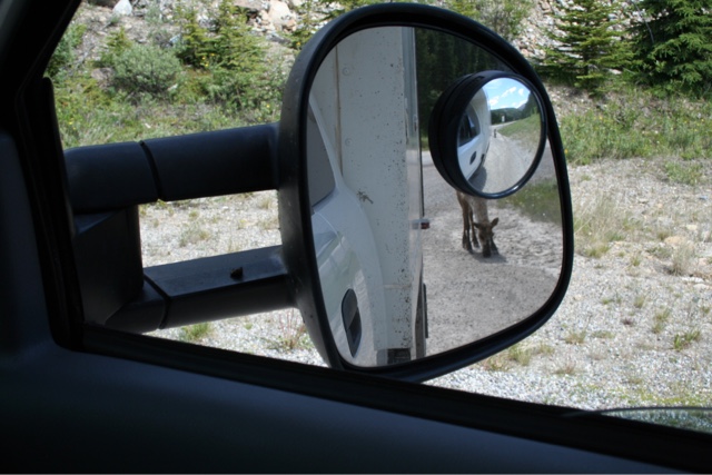
Saw this caribou, pulled over, it ended up right behind us.
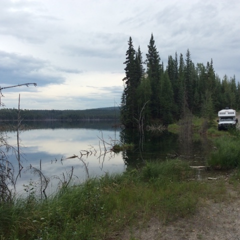
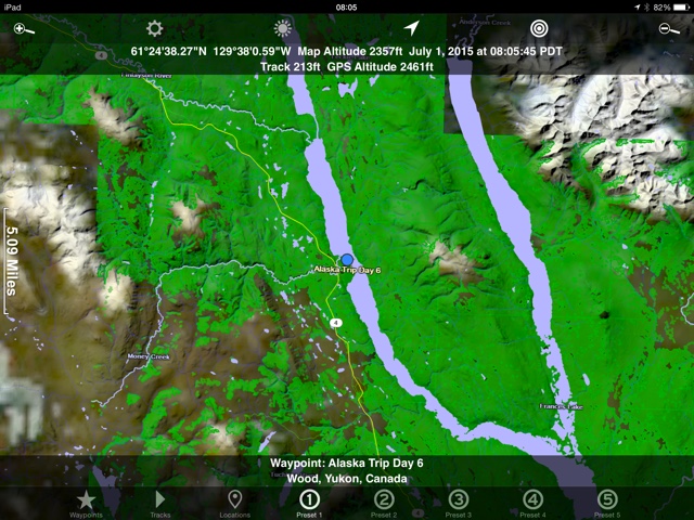
Day 6 Money spent: 170 canadian gas 153 groceries 12 campground fee Mosquito Wars, 4 kills and 1 bite. It’s finally cold enough to close the windows at night. Left camp relatively early and headed north towards Williams Lake. The road was the worst we’ve seen yet, but not terrible and still paved. We saw plenty of wildlife including 3 black bears and many buffalo. Filled up both tanks at Contact Creek store about 35 miles southeast of Watson Lake. The price was 115 per liter which is 30 less than the last fill in Ft Nelson. With a range of around 700 miles finding fuel shouldn’t be an issue with our upcoming adventures. Got to Watson lake and spent several hours at the visitors center. They were very knowledgable regarding roads, weather, etc. Filled up the water tank and topped off on groceries too. You would think we were crossing Africa or something. I read about the dirt roads and lack of services so was being extra careful. Turns out the dirt roads are better than the paved ones and this isn’t exactly the wilderness adventure expected so far. While cruising down the scary and trecherous dirt road a 30 foot bounder motorhome pulling a boat blew by me. Maybe being passed by a giant class A motorhome on a narrow dirt road does qualify as trecherous. We made about a hundred miles into the Campbell highway before my navigator insisted on stopping in a campground. I generally dislike the campgrounds and avoid them like the plague. This night however we were tired and not willing to search for a better spot. That is something that has surprised me thus far. I thought it would be much easier to find camping areas along the road. Yes there are plenty of empty gravel pits but anything along a lake is difficult to find. I’m missing our national forests with their abundant access in the states. Camping in Frances Lake Campground
Camping picture
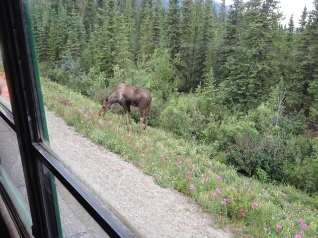
The constant daylight is starting to get interesting. No, it’s not exactly constant yet but for this early to bed early to rise person it’s taking some getting used to. The other night I was reading in bed thinking it was around 7pm. The clock showed 11:23. This morning I woke up feeling rested and ready to roll. Clock showed 4am which was 6 hours of sleep when I usually get 9. I find myself looking at a clock more to see what I’m “supposed” to be doing. Just another foraging bear. We were seeing two a day for a few days.
Some beefalo lounging 30 feet off the road.
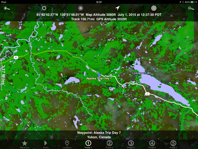
Day 7 Cost 0 Mosquito Wars, 55 kills, 5 bites. Our shortest travel day yet. We’ve been saying it would be nice to stop early if we found a decent camp spot. 11am saw us off the road and enjoying a lake atmosphere by ourselves. We took the time to cook up a few meals for reheating later, then I made a short lived camp fire. I was hoping to see a moose or three but no luck. There was a common golden eye duck with her three babies entertaining us on the nearby pond. In the early afternoon the mosquitos showed up en masse so inside watching movies finished off the day. Camp map
Campsite

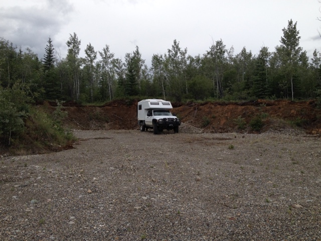
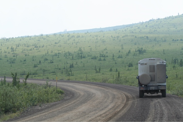
Day 8 Cost 77 fuel Canadian Mosquito wars, 45 kills, 13 bites After another bug battling night we were highly motivated to go north. Maybe the bugs are so bad here because it’s a warmer than usual summer. Perhaps if it gets cooler it won’t be so bad. Todays plan was to see the North Canol Road. I had read on a forum someone said it was the most beautiful road he had ever seen. After just over a hundred miles on the Campbell Highway we stopped at Ross River for fuel and info. Fuel was only 110 per liter so we filled up again. Crossing the ferry north of town was fun then up the bumpy dirt road we went. So how can I put this without being negative Nancy. The East Campbell highway isn’t very scenic. It’s relatively flat terrain and the trees on both sides of the road make it like driving through a tunnel with no roof. We had concerns that the north Canol road would be the same. We learned at the gas station that the road was closed for maintenance half way up at 75 miles. I said I was willing to do 50 miles if it was another maze/tunnel road. The road wasn’t terrible, but not great either. I think we averaged about 20 mph. We saw a bear and several rabbits and caught glimpses of a couple lakes. We turned around at 35 miles. I know, where’s your sense of adventure blah, blah. The thing is there are plenty of places to see and roads to drive. Maybe the real beauty of the North Canol was way past the half way point. All I know is we were tired of seeing the scenic beauty of trees 20 feet off the road. We were also excited about getting north and into Alaska. After blasting back down the Canol and crossing the ferry we turned west again on the Campbell highway. It was paved now and opened up considerably giving us the scenic vistas we were longing for and maybe even justifying our early bail out of the North Canol. This night we tried a new bug strategy. I read somewhere that a mosquito only has a range of 40 feet. Maybe if we park in the middle of a gravel pit they won’t harrass us. So far the evening of Day 8 has been bug free, peaceful, and cool. Camp Map
Camp site
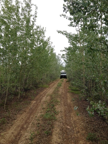
Exploring some back roads, looking for camp.
Lunch stop and turn around point on the North Canol Road.
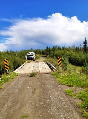
Ferry crossing at Ross River.
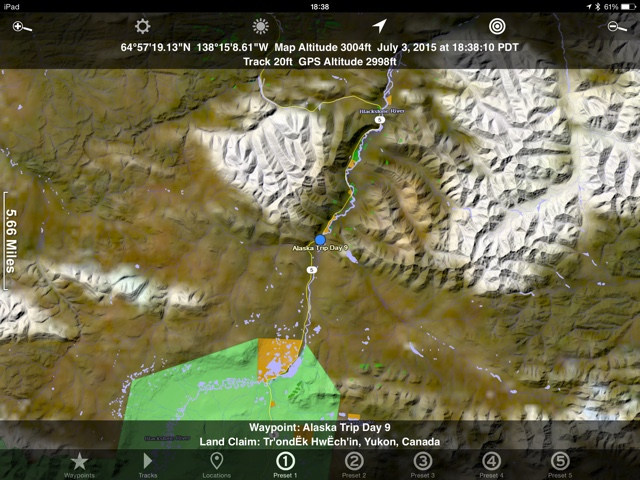
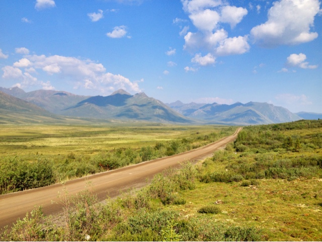
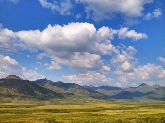
Day 9 Cost – Fuel 129 Canadian Mosquito Wars, 20 kills and 4 bites The Dempster Highway is Awesome!! Maybe the guy on the blog was talking about the Dempster instead of the North Canol Road. It’s breathtaking even covered in forest fire smoke. The gravel pit seems to work. A full nights sleep was had by all. We woke early and had some fruit and cereal before heading out. The goal today was Dawson City for fuel, then up the Dempster Highway. Drove in rain most of the morning on the west part of the Campbell highway. This is the worst road so far by the way with sudden pot holes, repairs, and sunken parts. Got us bouncing a few times and bottomed out the front once. As I type this I wonder what we do all day. The time seems to fly by with a few rest stops, lunch, road construction delays and maybe an interpretave center or two. Oh yeah, we did walk a short distance down a beaver marsh trail. One of us got tired though so we turned back. Ok, back to the story. Turns out Dawson City is 25 miles past the turnoff for the Dempster Highway. Instead of going to Dawson and back we fueled up at the well placed station at the junction. Soon after turning up the Dempster it became clear that this is what we have been waiting for. It’s like Colorado mountains with Montana skies and Minnesota’s water in between. It’s the type of scenery I’ve been expecting ever since leaving Hope, B.C. There is considerable smoke in the area. When I asked where the fire was the lady in the interpretave center said there are currently over a hundred fires in Yukon and Alaska. We are hoping that tomorrows weather change will bring a wind shift and clear things up. Still debating whether or not to go all the way up to Inuvik. No real reason to go up there, but hey, no real reason to be here either. We’ll decide tomorrow upon our arrival at the arctic circle. Camp Map
Camp site picture.
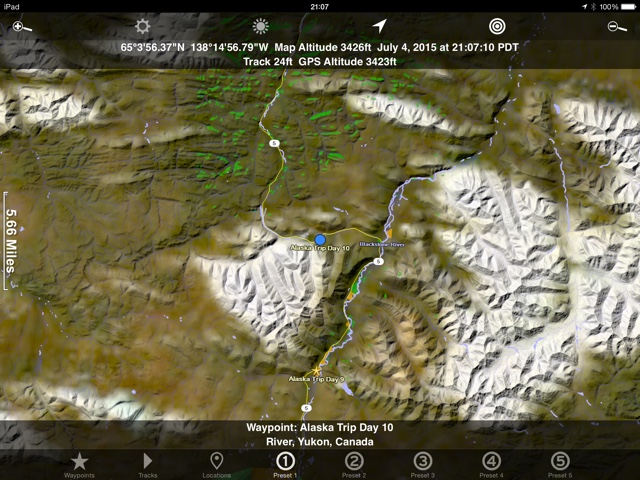
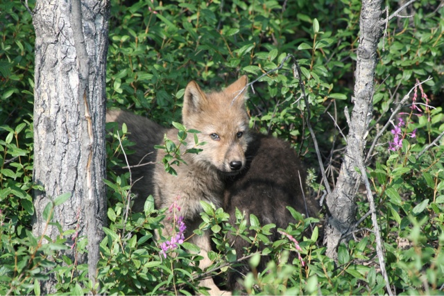
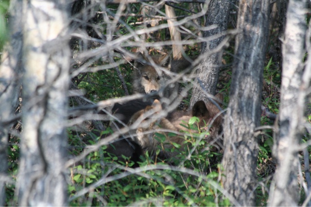
Day 10 cost 0 Mosquito wars, 26 kills and 6 bites Yeah, I had lunch at the Arctic Circle today. We left camp at a reasonable hour. This whole light all the time thing is getting strange. Difficult for my body to know when to sleep. If it’s cool enough we put the black out shades down and that helps. Today we go to the Arctic Circle. About 250 miles of dirt road. From what I’d read I thought it was going to be more difficult but no, once again the 30 foot class A motorhomes are here. As we get further down the road I bet a few of them had some tense moments. The road got downright muddy in a few spots. Certainly a place where you’d want to keep the bounders gas pedal in the down position. The Dempster Highway is very beautiful in spots. It did go back to the trees on the side of road thing with virtually no view, but it’s so worth it on this one. The smoke was still bad this day so we were missing the really good vistas. We drove for 4 or 5 hours most of the road being very good but a short section was 20 mph or lose your fillings. Upon arriving at the Arctic Circle I was pleasantly surprised to find…. nothing. Just a sign, garbage cans, and two outhouses. I love it, maybe we really are getting out there. We had lunch in the Arctic and debated going on or going back. In the end it was decided that we’d rather spend the time somewhere else. We would have lost two more days to go out and back and it just didn’t seem worth it. I almost felt ahamed about turning around. In fact of the half dozen cars that came by we were the only ones to turn back. Maybe I’ll go back some day. The way back was really cool. Mostly because we saw….. wait for it….. wolves. Not just a lone wolf running miles away, we saw 4 wolf puppies. They were lounging in the road and only moved off when we got close. They were about 15 pounds each, two tan and two black. They played their way into the bushes and out of sight within a few minutes. We also saw a large black bear and two moose. The drive back went fast. We ended up fairly close to the previous nights camp. The plan was for an early night so we could get up and look for animals the next day. Camp map. Very close to day 9 but still drove 300 miles or more to the arctic circle and back.
Campsite picture
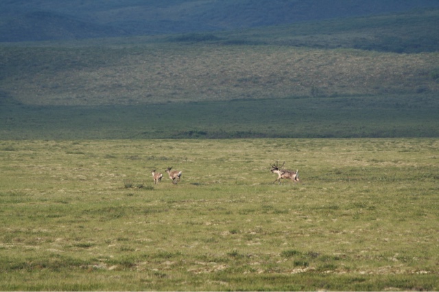
Day 11 Cost 160 Canadian Fuel, 36 Campground fees with showers and laundry Mosquito wars, 27 kills and 10 bites Best day yet for this happy traveler. Up at 4:26 and on the road early. We had the best part of the Dempster ahead of us and the smoke had cleared significantly so we wanted to get out and see something. First sighting was a moose in a lake as we ate breakfast. Then three Caribou were bounding along the road. Then we stopped so I could go to a hilltop and scan with the bino’s. I found a moose and her calf and watched the caribou crossing the tundra. A few miles down the road we had a perfect vantage point so stopped again and got on the roof for more searching. From here we watched the moose and calf move several miles across the valley from us. I also found another moose in another pond and a pair of swans and goslings. I got Mom up on top of the truck and we sat there for over an hour in perfect temperatures with minor mosquitos. Camp Map

Campsite I know…..
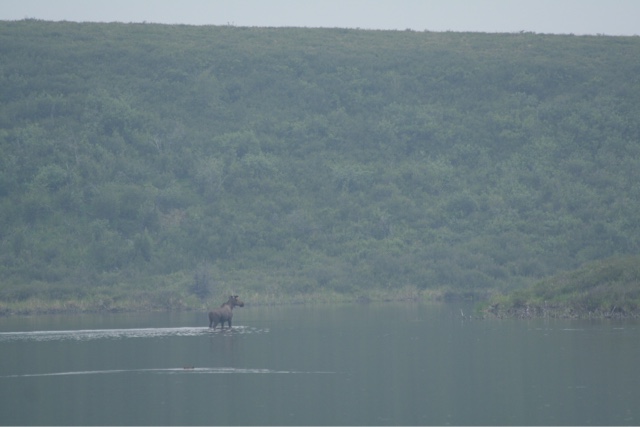
Breakfast moose
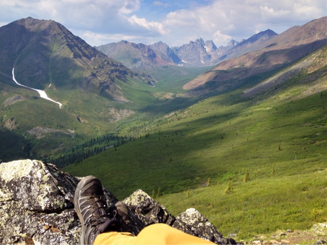
After getting our nature fix we headed for Dawson City. Still on the Dempster we passed the grizzly creek trail and I did a U turn to check it out. My old body was screaming for excersize so I grabbed a pack and some shoes and took off. The hike was well worth it and I have pictures to prove it.
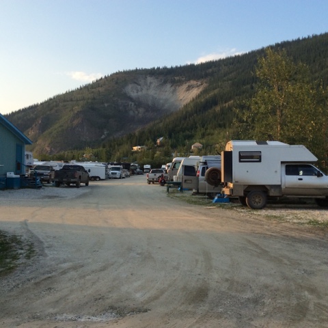
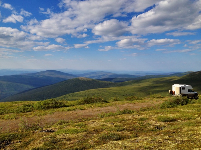
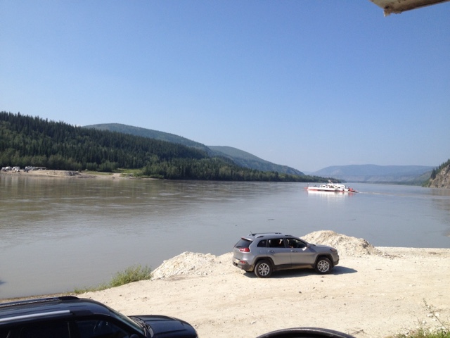
After the hike we got to Dawson City. Yep we paid for camping again and ooh what a place it is. Ok negative nancy be careful. It was time for showers, wifi, and laundry. Tomorrow we will be tourists in Dawson and then cross into this Alaska place I keep hearing about. Day 12 Cost 5 Canadian Dredge #4 Tour Mosquito Wars, 0 kills, 0 bites. I know amazing huh. They must spray for them in town. It’s a tourist and internet day. Stayed up late updating this journal so didn’t get rolling early. Slept surprisingly well in the campground. No mosquitos at all. Spent the morning finishing up with internet stuff and breakfasting. Went to the visitors center mid day to learn what the town had to offer. I chose to do a dredge tour. Dredge number 4 still sits at the top of bonanza creek where it sunk sometime in the 50’s I think. This dredge is 8 stories tall and hundreds of feet long. It could dig 56 feet down in the creekbed. It averaged 200 ounces of gold a day and on its best day picked up 800. It ran for 46 years before it sunk. It was a cool tour. After the tour we “shopped” around town. What that really means is that I wandered into three stores with Mom before I got bored and wandered around town while she hunted down that elusive apron. After lunch we got in line for the ferry across the Yukon river. Had to sit in line for an hour but it’s a quick trip once aboard. We got on the top of the world highway headed for the Alaska border. We were making a run for it when the terrain begged for us to stop. A side road presented itself so we took it finding a wonderful campsite just this side of the US border. Camp Map
Campsite
Ferry crossing the Yukon River.
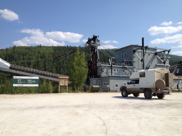
Dredge number 4
If you look on yesterdays map you will see all of the blue lines that are now ponds left after the dredge went through on the klondyke river. Day 13 Cost Fuel 48, groceries 151 Mosquito wars, 1 kill, 0 bites Woke up to a windy mosquito free day. Drove down off the camping area onto the main road which is now called the Taylor highway. Turns out we were only a couple of miles from the Alaska border. The crossing was a breeze especially compared to my normal crossing routine. Coming into Canada this trip was a 2 hour wait while they searched every nook and cranny of the truck. The road got narrower and bumpier as we went down in elevation. Passed the town of Chicken and smiled without stopping. Seemed very touristy. I’m sure we missed the worlds greatest pie or fried chicken or something. Got down into the flat lands turned back onto the Alaskan highway into Tok. Stopped there for more groceries and some fuel. A good selection of food there but about half to a third more than normal cost. From Tok we went North towards Delta Junction then west to Paxson. Road construction held us up for an hour near Delta and the smoke was terribly thick from local forest fires. As we were driving in our line through the construction zone we saw a moose and her calf wandering by. It started raining in this area and didn’t stop all day. Rained really hard which is great because the truck still has caked on mud from the Dempster highway. Nearing Paxson we got our first look at the Alaskan Pipeline. We wanted to tourist it up a bit, but the rain kept us inside. We are currently a few miles up the Denali highway from Paxson. It’s very beautiful. There are thick clouds still, but we keep getting a glimpse of snow covered peaks to the north. Settled into our lakeside camp for the evening and made up a pot of potato soup. Camp Map
Campsite
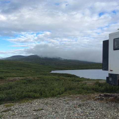
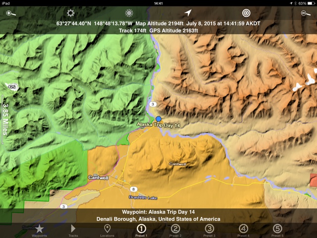
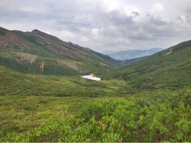
Day 14 Cost 0 Mosquito wars, 8 kills and 2 bites. Less mosquitos in Alaska so far. We haven’t decided yet, but the denali highway may be as good as the dempster. I guess since it’s only 134 miles long as opposed to nearly 500 that puts it in the well worth traveling catagory. Oh and by the way, it also connects to something so it’s not neccessary to backtrack. Woke up to low rolling clouds and some sprinkles. Was hoping for more blue sky to see the mountain tops that peaked at us a few times yesterday. In many places it was so beautiful that I was only driving 30 miles an hour to take it all in. We saw 3 moose today but none up close. Theme of the day was scenic beauty. We only drove the length of the Denali Highway today and are now parked about 20 miles from the park enterance. Tomorrow should be a big day in the park. I’m not proud of this campsite. In fact I wouldn’t be surprised if we get kicked out. We are parked on an access road to what looks like a gravel plant. This close to the park we were concerned with the availability of camping. We will check out some BLM land on the other side of it tomorrow. ………… Campsite update. We didn’t get kicked out. While watching a movie a moose wandered by soon followed by a huge black bear……….. Camp map
Campsite
The Denali Highway
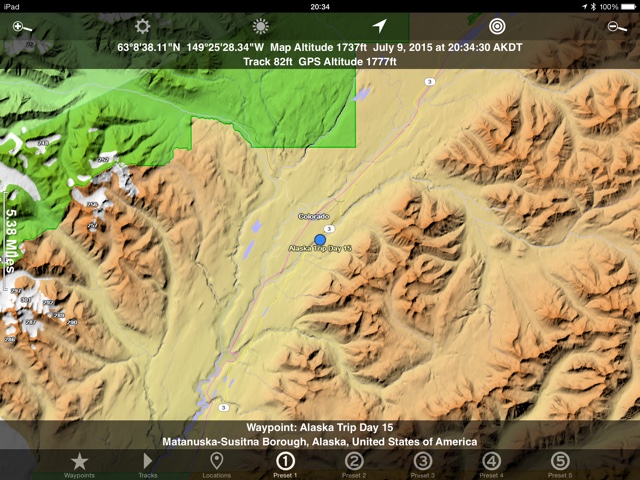
Day 15 Cost 70 dollars for bus tickets Mosquito wars, 5 kills and 2 bites Denali National Park We made it to Denali. We arrived early and scheduled a bus ride to the Eilson visitors center. Would have loved to drive into Denali ourselves but it isn’t allowed past the 15 mile mark. I’m not sure what we were expecting. Maybe a shuttle system like Glacier where you hop on and off small vans throughout the park. This was a little bit different. We got on a school bus with an 8 hour round trip planned. We immediately saw a moose along the road and we all jumped out of our seats and stuck cameras out of the windows. The scenery is breathtaking and we did see some more animal life including dall sheep, more caribou, and finally, a grizzly bear. We rode up for about two and a half hours when Mom says “lets blow this tour and head to Valdez”. It’s exactly what I was thinking but didn’t want to say in case Mom was loving it. So yes Denali is very cool but you really need to hike to see it. We got off the bus and I went on a short hike while Mom hung out at the stop. Soon it started raining and the clouds settled in. We caught a bus back and had a 5 hour trip instead of 8. I may have to come back some day with my backpacking gear. The really cool thing about Denali is that they encourage you to go wherever you want on foot. Up a creekbed, over a mountain, along the road, whatever. After Denali we drove west towards Palmer. Almost bought gas in Cantwell until I saw the price of almost 5 bucks a gallon. We stopped along a river next to the highway. Camp Map
Campsite
Our moose shot from the bus.
This is a poor representation of Denali Park. It’s mostly big open beautiful country.
Copilot searching for critters along the highway.
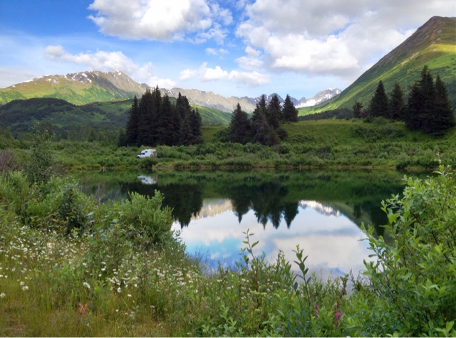
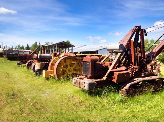
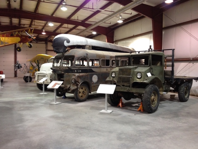
Day 16 Cost, Fuel 122 dollars Museum fee. 13 dollars Mosquito wars, 10 kills and 3 bites This day we were headed for Homer or Seward, still undecided. Main objective is an oil change and a stop at the transportation museum in Wasilla. The museum was a good one although probably better for my dad than Mom and I. Lots of old rusting equipment. Some really cool restored snowmobiles and outboard motors from the way back. I enjoyed seeing a piece of equipment and trying to figure out what it was for. After the museum we got the oil changed in Wasilla then found a McDonalds for wifi usage. By mid afternoon we were once again on the road headed Southeast. After a couple more hours we found one of the more beautiful campsites of the trip thus far. We are only a quarter of a mile off the main road but you wouldn’t know from the campsite pictures. Camp map
Campsite
Museum
Love those retro lights

Alaska exploring.
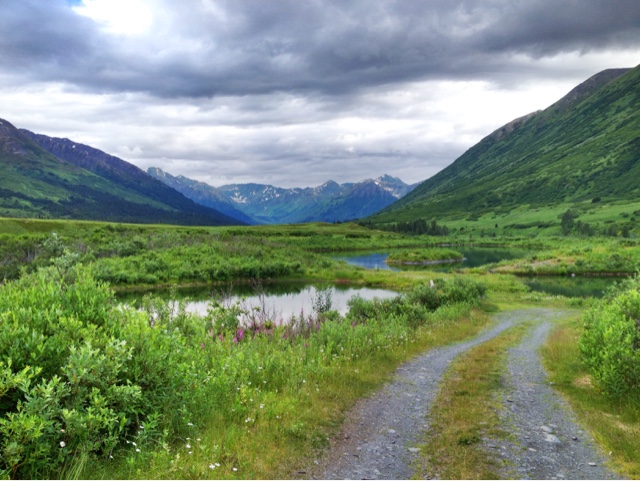
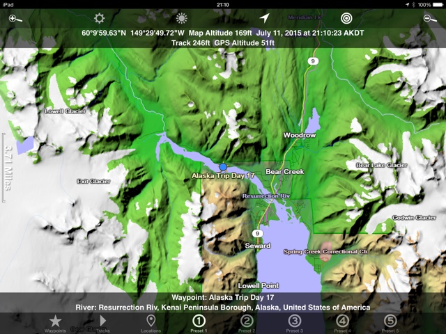
Day 17 Cost 0 Mosquito Wars, 2 kills, 2 bites On towards Seward today. I found a hike while reading about Seward so that’s where we are headed. The trail starts at the exit glacier nature center in the kenai fjords national park. I left the parking lot at noon which sounds really late until you remember that it never gets dark here. I could come stumbling back at midnight and still not even need my headlamp. The hike turned out to be one of the best I’ve ever done. The views were breathtaking. The hike went from the valley floor up to the Hastings ice field. It follows the exit glacier up the mountain. After the hike I was pretty well done. I had a shower then we camped in the riverbed of the glacier a few miles down the road. Made an excellent veggie and rice stir fry then crashed. I’ll let the pictures do the rest of the talking. Camp map
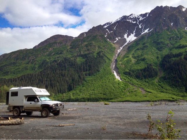
Campsite
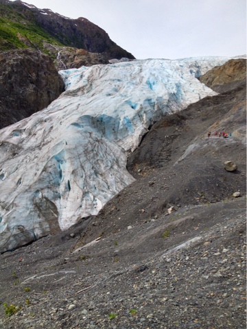
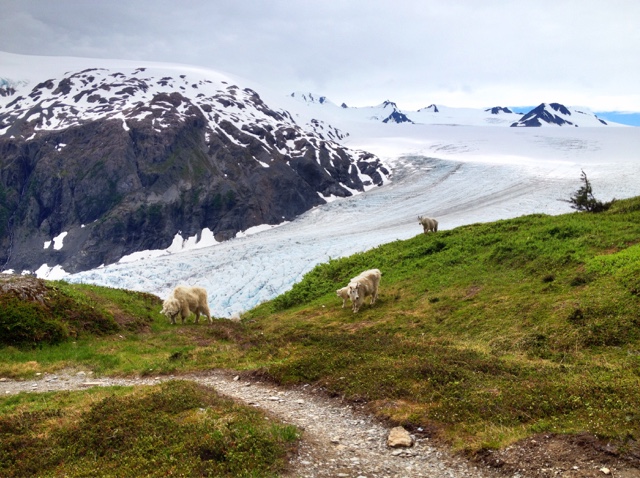
Exit Glacier look for the humans for some scale.
Glacier from higher up and a few mountain goats.
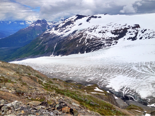
One more, this glacier thing is still new to me. Fantasmic.
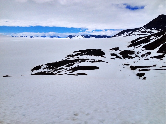
At the top. Hastings ice field.
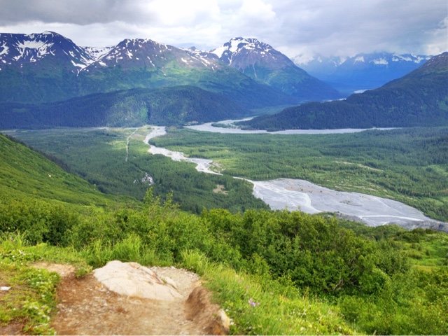
Looking back down at the parking area.
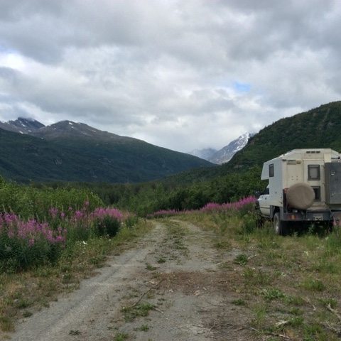
Day 18 Cost 66 for fuel 75 for groceries 30 for mogolian BBQ Mosquito wars, 15 kills and 3 bites The bad part about doing a journal every day is that some days aren’t going to be very exciting but you have to write about them anyway. This was one such day. Basically just a driving day from Seward to an hour short of Valdez. Seward was cool to see. Holy RV batman. There must have been a thousand RV sites in town by the water. When we saw that and the cruise ship parked at the dock we decided not to stay long. We filled up the water tank and got back on the road after getting some groceries at Safeway. The drive back to Anchorage was just as scenic as the way in. In Anchorage we did something crazy. Must have been good marketing or something because the Mongolian BBQ sign just drew us in. A rare fancy dining experience for us. The rest of the day was uneventful, just more driving with more nice scenery in and out of rain showers. Our camp site is decent. Off the road a bit, enough to be private. Looking forward to checking out Valdez tomorrow. Camp Map
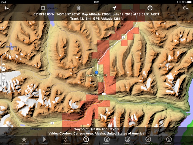
Campsite
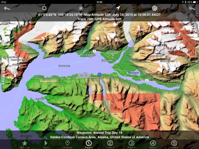
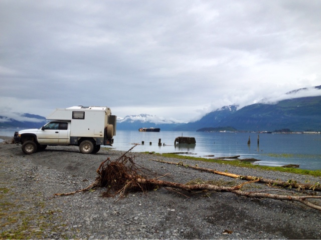
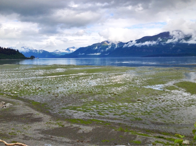
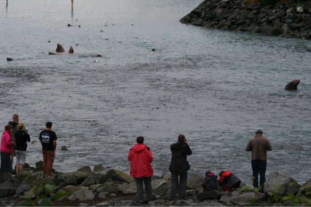
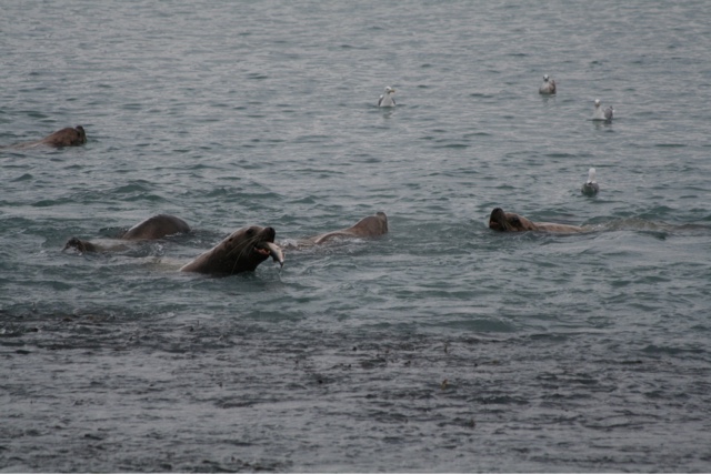
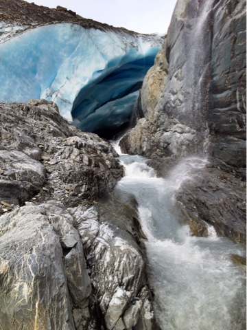
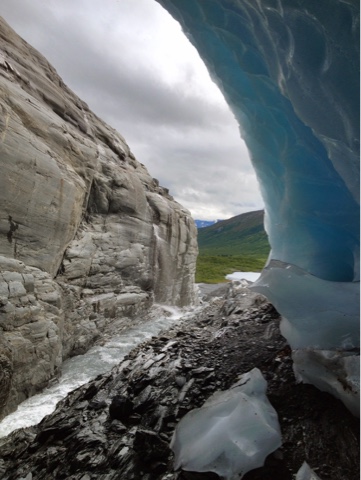
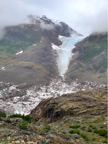
Day 19 Cost 73 dollars Groceries Mosquito Wars, 7 kills, 3 bites Several minutes from our campsite we came across Worthington glacier. This one is cool because you can walk right up to it. It’s a neat feeling getting right up against a glacier. For one picture I dashed inside. My caveman instincts kicked in screaming at me to get out of there. It was really spooky knowing that a piece or maybe even the whole face could fall in and get me. After an hour of glacier exploring we headed into town. The drive in is very nice. It was more than that, but I feel like I’m saying beautiful, amazing, etc. too much. The town itself … meh. We looped through town and right back out again. Our goal in Valdez other than just gawking at the beauty was to try and see some bears catching salmon. First we checked out the old Valdez town site. In 1964 an earthquake demolished the town and it was moved 4 miles west. The old town site is still there with signs showing where the buildings were. From there we went to Alison Point off of Dayville road. There is a fish hatchery there that is known to attract bears. It is a really cool site but not because of bears. We hung out at the hatchery all day hoping for a bear to show and watching the other animals dine on salmon. The stars of the show were giant sea lions. They must be 5 to 700 pounds each. They catch and then rip the salmon in half to get the good parts. There are also otters, eagles, fur seals, and about a million sea gulls here. I stayed up way past my bedtime waiting for Mr. bear to come along. Finally driving out at midnight with no sign. Camp was a mile or two down the road. It was one of those park the truck, brush teeth, and climb into bed deals. Mom was long ago asleep and barely even noticed the move. Camp map This is actually allison point. I didn’t get the campsite map because it was so late. There are numerous places to camp in the area.
Not a campsite pic, but one from the old town location. You could, and we almost did camp here.
View from Allison Point.
Salmon, seals, and humans.
Getting dinner.
Worthington Glacier.
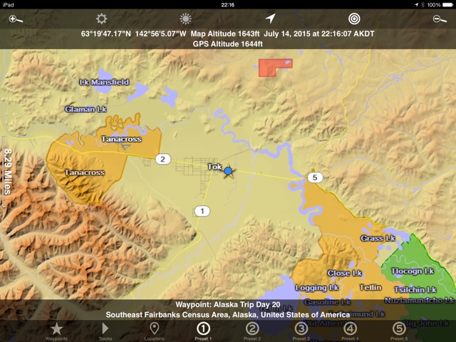
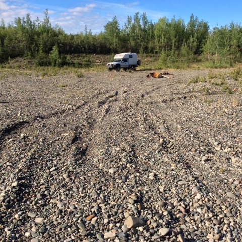
Day 20 Cost 140 dollars fuel Mosquito wars, 5 kills and 2 bites Woke up early and went right back to Allison point to maybe catch a bear. No luck though. Had a big pancake breakfast while watching the seals and seaguls again. And what follows a big breakfast for those of us over 40. A big nap of course. Had a little bit of sleep to catch up on. While sleeping I heard people walking by talking about a mother and three cubs. Not sure where they were, certainly not at our little point. Post naps it was time to head south. From Valdez to about 15 miles out is exceptional scenic terrain. After 5 hours of driving and a few short excursions looking for a cool camping spot we ended up just outside the town of Tok. We thought about going further but decided to stay close to town so we could do laundry and find some wifi tomorrow. Camp map
Campsite pic. A gravel pit a couple miles outside of town.
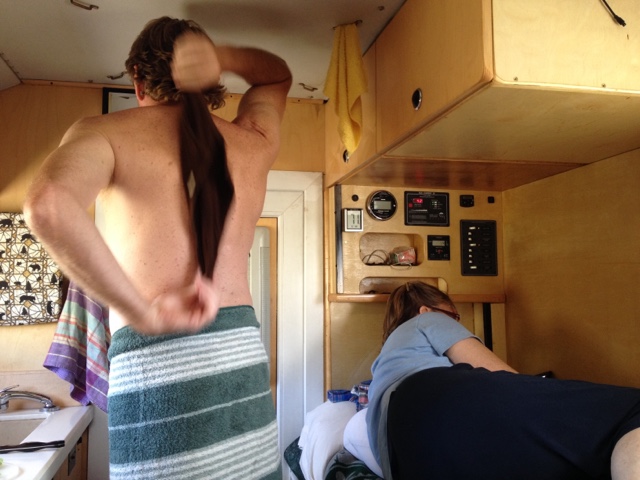
Psuedo shower with one’s mother a few feet away. Yes, strange indeed.
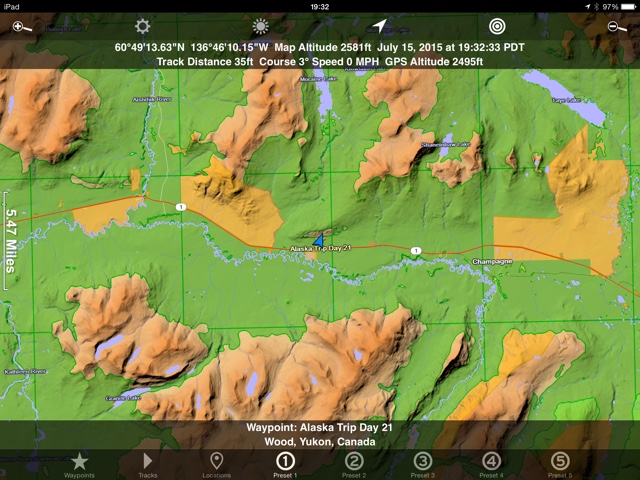
Day 21 Cost. 0 Mosquito wars, 2 kills, 0 bites Today we drove and drove. We are headed back to the contiguous states of America. Mom and I keep asking ourselves, is that it, are we done? Yes and no. We are hoping to stop and explore a few more destinations on the way home. Hyder sounds like a good one to check out so that’s where the focus is for now. Must get to Hyder. Although we have a focus it won’t stop us from slowing down and checking out anything interesting. Tomorrow we’ll look at Tahini hot springs. The book seems to indicate that it has potential. Todays travels covered just over 300 miles. Considering the rough roads, the construction, and the dirt roads, it’s often difficult to make the miles. The good part is, it’s almost always scenic. Camp Map
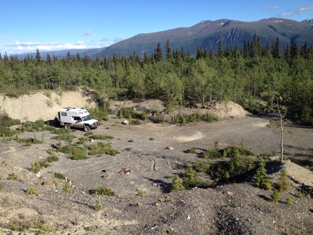
Campsite
Mom in her “room”.

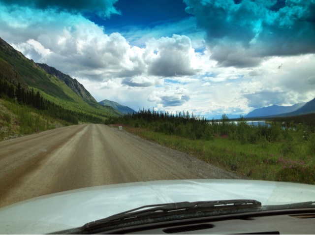
Still in beautiful country.
Lunch stop. Purdy.
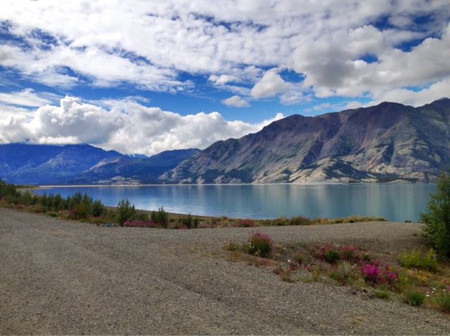
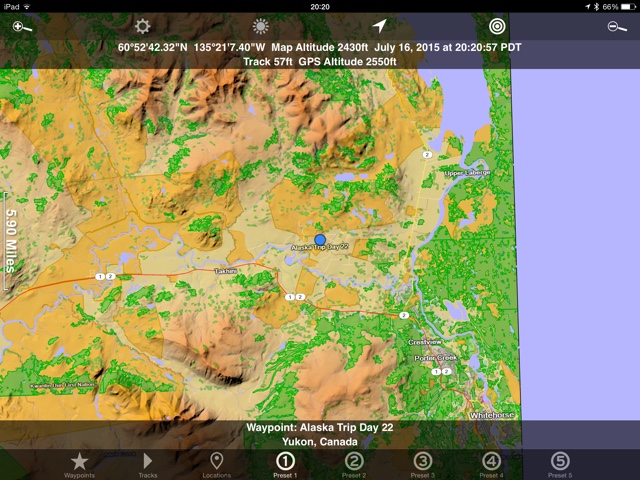
Day 22 Cost 27 campground and 18 for the hot springs Mosquito wars, 1 kill and 0 bites. Don’t worry, we’re headed back to mosquito country tomorrow. I looked in the hot springs book last night and found out there is a commercial one right down the road. Even better is that they have wifi and laundry in the campground next door. We only drove for an hour before arriving at Takhini hot springs. After checking out the spring and the campground we gave it two thumbs up and now here we sit. Mom soaked for a couple hours and I soaked for a couple more. We then returned to the campground where we found out there is no laundry and the internet is very spotty. I can see as I type this that I’m 8 days behind in my updates so will make an extra effort to either stay up late, get up early, or stop somewhere else to get them out. We met some nice folks in the hot springs. Bruce enjoy your vacation, Brandon and Jill, I hope you have a good time in Homer. Tomorrows plan is to go to the real transportation museum tomorrow. Turns out the one in wasilla was an imposter. One of us also needs to do laundry again and another one of us still needs decent wifi. After those mini missions are accomplished we blaze SE towards Watson Lake. Camp map
Campsite
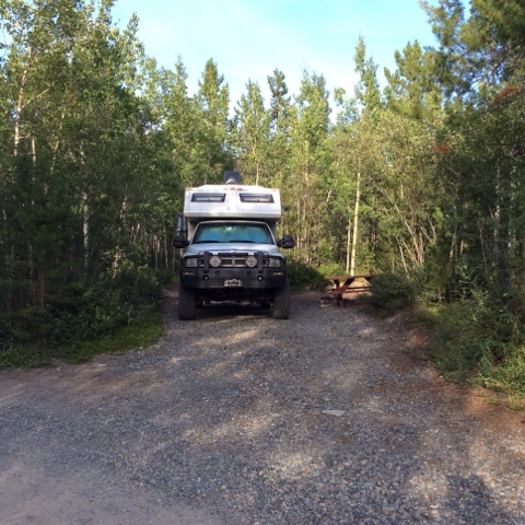
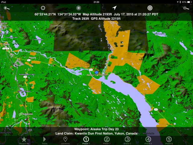
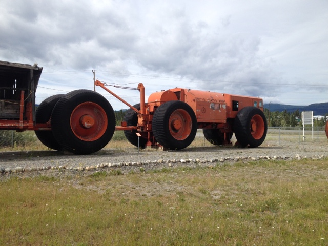
Day 23 Cost, all canadian. 122 for fuel, 125 for gorceries, 18 for the museum, 4 for McDonalds, 10 for laundry, and 106 for a water pump and supplies. Certainly our most expensive day yet. Mosquito wars, 3 kills and 1 bite. The departure from the RV park was fairly early. Filled up the water tank and hit the road for Whitehorse. A big day of resupply and the real transportation museum were planned. Unfortunately another task was added to the list. I checked the trucks fluids in the RV park and found the anti-freeze low. I also found a small drip spot under the truck. After filling it and checking a couple more times throughout the day it became evident that the leak was from the weep hole in the water pump. A sure sign of impending failure. The first stop was the Laundromat which is always a fun time. We then tried McDonalds for some wifi and sending these posts out. It didn’t work at all but the hot fudge sundae was good. Next the grocery store. Mom went in alone while I researched what I’d need to replace a water pump. I later joined her so we could fight about what food we could get. She seems to think we are in a 45 foot bus with 3 refridgerators and I seem to think we are in a mini cooper with a 6 pack cooler. We always work it out though. Napa and a new water pump were next. I really hope I got everything I need. If not tomorrows write up could be a lot longer. Lastly we went into the library. After several unsuccessful attempts with wifi the library finally proved to be the place. I got all posts sent out and emails replied to. We were surprised to hear the librairian say “we close in 45 minutes, at 6 oclock”. The long daylight is sitll making the night sneak up on us. From the library we went East for about 15 miles. I wanted to get out of town enough to work on my truck and not be hassled. But close enough to town in case we needed to limp back or maybe be towed. So here we sit. Already had dinner, watched a movie. Only a few minutes left for a quick blog post and reading before lights out. Or, blinds down that is. Wish me luck with the water pump change. I may need it. Camp Map
Campsite
From the transportation museum
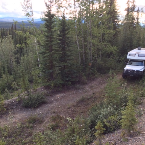
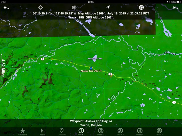
Day 24 Cost 0 Mosquito wars, 8 kills, 1 bite Water pump. I told Mom this morning that we had better do something exciting soon because it’s silly to type out our day when nothing happens. Today was a good one none the less. Started out by doing some back woods truck repair. I did indeed change the water pump in the bush. It took a couple of hours but would have been much quicker had I not messed with the fan belt. The belt needs replacement and it would have been the perfect time to do it except for the fact that I have a horton fan clutch in the way. I decided to tackle that one when I’m not in the woods. Hope the old one can hold out for another couple of weeks. The new water pump and old fan belt are working well together. We drove a couple hundred miles after the repairs and ended up at a nice little lake just west of Watson Lake. We plan on using internet there again tomorrow for a short time then driving on towards Hyder. Camp map
Campsite

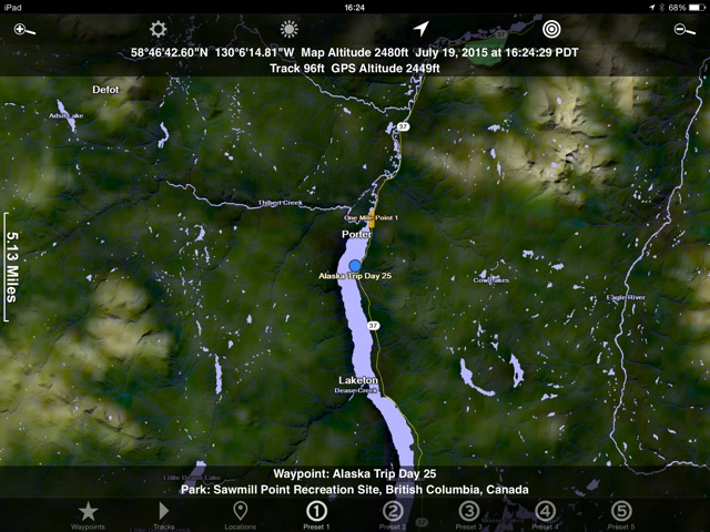
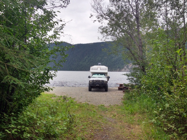
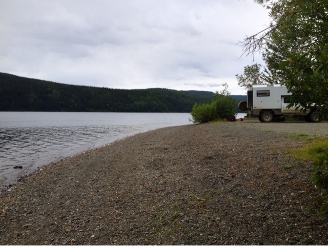
Day 25 Cost 89 Canadian fuel Mosquito wars, 12 kills, 5 bites On the road again. Seems to be a fairly consistent theme on this trip. Today did turn out to be a little bit different however. The book spoke of a “rustic” camping area next to the north end of Dease lake. Ooh, we said, rustic might just mean free and perhaps less ammenaties so less humans. Sure enough, the campground at sawmill point at Dease lake is free and very nice. Since arriving at noonish we had the pick of sites and chose one right on the water. This was going to be so cool, time to gather wood, break out the chairs and kick back by the lakeshore. After I was going for my last load of wood I came across a sign. “Burn ban in effect in all of B.C.” Oops, so much for gathering wood. Wish I’d read that sooner. The mosquitos came in force soon after that and without a campfire we bailed into the house. The day was still a good one. I made a wonderful stirfry and then we watched movies. We have great views out every window. Other campers came in later in the day. Everyone seems like minded and doing basically the same thing. We had a very nice sleep with rain most of the night. Camp map
Campsite
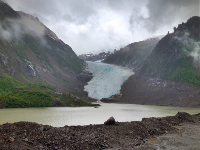
Day 26 Cost 4 dollars for Mom’s ice cream cone and graham crackers. Mosquito wars, 5 kills, 3 bites Pay attention on this one now because it’s getting exciting again. A driving day of close to 300 miles again was in store. The closer we got to Hyder the more beautiful it got. The road from the Cassier highway to Hyder is breathtaking. I think the road is 37a and it’s well worth the out and back. In fact I normally dislike backtracking, but in this case I’m looking forward to it. The craziest part is that we could only see about half of what is out there because of low clouds and rain. We stopped at the visitors center in Stewart which is only two miles from Hyder and the bigger of the two towns. There we got enough of the local scoop to figure things out. First stop, across the street to the grocery store which oddly enough is the only place with free internet. By now the weather had gotten worse. Socked in with rain. I asked the grocery store clerk what the weather was supposed to do and she said 7 more days of this. Bummer. Mom and I parked ourselves outside the store at a covered table and chairs. Mom ate her ice cream while I just enjoyed not driving or being rained on or being chasesd by mosquitos. As I sat there I saw some cool RV’s. This place is like the who’s who of exploration vehicles. A global Warrior pulled into the visitors center soon followed by an XP Camper. I had only previously seen these two at the expedition expo years earlier and the XP was only a prototype at the time. It seems all manor of adventure vehicle come to Alaska and Stewart/Hyder. I was also chatting with a young guy on a motorcycle. This whole adventure motorcycling faze must be at it’s peak. Everywhere you look there is another 900cc motorcycle with dual purpose tires and the rugged paniers and crash bars covered in lights. Probably exactly what I’d be doing if I was 20 years younger. I feel for them on days like today though. It can’t be fun packing up a soggy tent for days on end. I asked the kid about it and he said, “no worries mate, I’m booking myself a room tonight.” Hyder is the other place we were hoping to find bears. Well, not find them as much as see them feeding on salmon. There is a place here where they frequent regularly. Upon arriving and chatting it up with the ranger he said we are a week or two early. There were apparently only two salmon in the creek right now but in two weeks there will be enough for you to walk acorss on their backs. Yes, he had seen bears, but they were just passing through hoping to find the salmon. The good news, they like this rainy weather. I asked him about camping and he told me about a ‘secret’ spot. As we were starting to leave he said now you didn’t hear it from me, but if you look a little further, there just might be another faint road that goes somewhere else. When we left he said something like, “good luck not finding the place I didn’t tell you about”. We found it. It’s still difficult to tell at this point, but we seem to be somewhere in the vicinity of where Bilbo Baggins went to find the castle. Hopefully the weather will break enough to get some better pictures tomorrow. Camp Map

Campsite
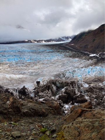
Here’s a cloudy shot of a glacier who’s name I forgot. It’s just a small part of the wonder we saw coming in. Why don’t I have more pictures you ask. Partly because I just want to see it and enjoy, and mostly because the pictures just can’t compare to what you see in person. I guess another reason is that you just see so much of it. It’s like, “oh look, there’s another giant waterfall, that’s the 23rd one we’ve seen today.”
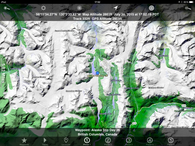
Day 27 Cost 0 Mosquito wars, 22 kills, 2 bites I got lost today. Still parked in the land of glaciers. We will stay here for the day and wait for a break in the weather for some pictures. You will notice the camp map picture is the same because we haven’t moved. Camp Map
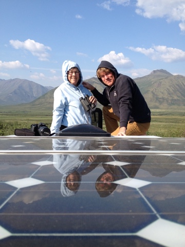
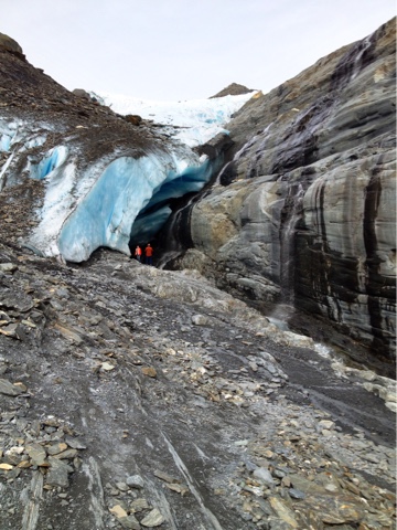
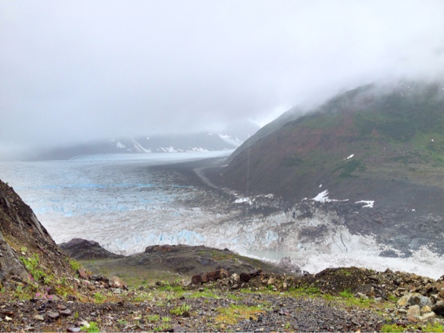
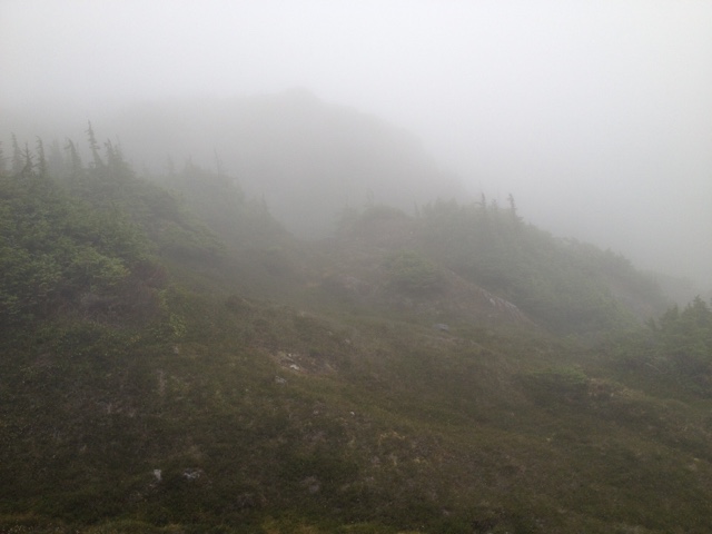
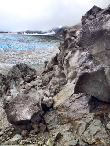
I woke up early to nothing but white so dozed off again. Same thing an hour later. Now I’m just laying there reading waiting for Mom to wake up. And reading and reading. Finally at 11am she wakes up and says “I was waiting for you to get up.” Yeah right Mom, she had been sleeping soundly for the last 3 hours. We weren’t moving fast, still nothing but white outside the windows. At first we read some more, then turned on the TV for a couple hours. This whole time I was watching the amperage from the solar panels. I’d never thought of it this way, but the solar panels could also be called cloud thickness detectors. When they were producing only 2.0 amps don’t bother looking outside. When they start getting in the 4.0 range the sun is coming. Eventually when it showed 4.5 I decided it was now or never. Backpack, shoes, rain jacket and off I go. The plan was to get down to the glacier to taste it. I was dissapointed with myself for not licking Worthington glacier so had to right this wrong. I wandered east and down. Before long I was under the clouds with expansive views of Salmon glacier. I followed the glacier down to the lake and behond to the river valley. I took my time getting many pictures along the way. At one point I sat for over an hour watching and listening to the ice crash and fall. One piece the size of a punch buggy rolled away not 50 feet from where I was. Scared me good going from quiet to something moving and crashing so close. After several hours I turned back towards the truck. I had told Mom not to worry, I’d be back well before dark. If not back by 9 then you can worry. I turned back at 7, once again misinterpreting the light and how late it was. No problem, the truck is just right over there. At 7:30 I got to where the truck should have been and saw this.
Wait a minute, there is supposed to be a flat gravel area with a truck parked there. I was thougherly surprised but not yet worried. The truck had to be really close. I wandered off in the direction I thought it was and not only did it not appear, I came to a cliff. Still no truck in sight. I was overlooking a valley with stream and ponds in the bottom. What the heck, how far did I follow that darned glacier. Getting a bit more worried now. I started backtracking but not on the exact same path. I tried two more times to look over the ridge because I was sure the truck was right there only to decend back down. Finally at 8:30 I had to give up all attempts to short cut back to the truck and go back down to the glacier. I found my way, eventually right back up the original path. I got back just before 9pm to a worried mother. Was it worth it, heck yeah. Check out these pictures.
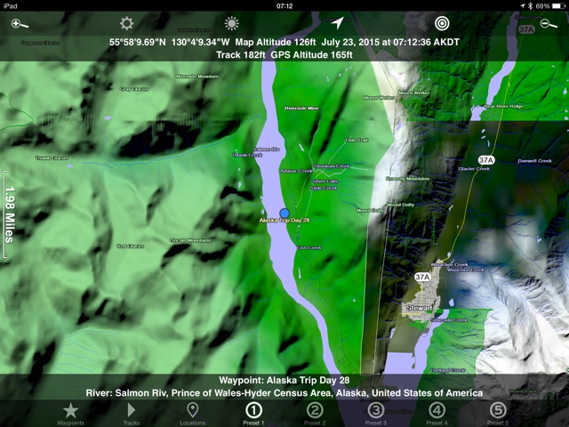
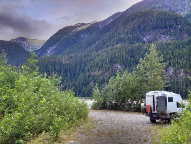
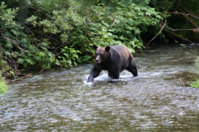
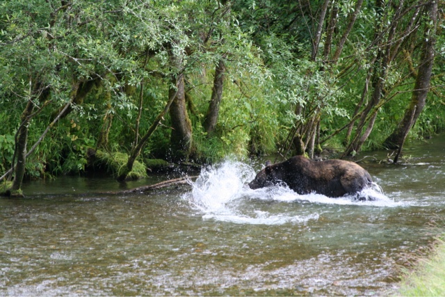
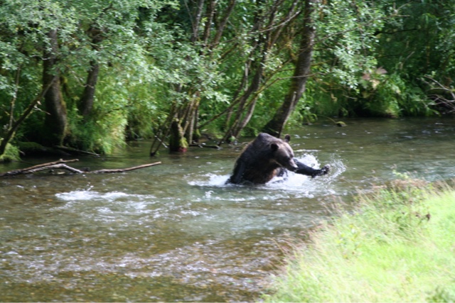
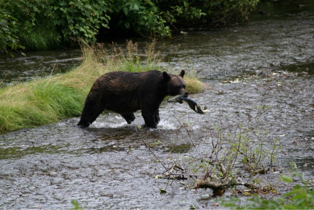
Day 28 Cost 10 for two recreation passes for bear viewing Mosquito wars, 2 kills, 0 bites Had to russle Mom out of bed at 9. I must be wearing her out on this trip. I would have taken pictures of the camp site, but we are fogged in again. We had a cup of tea and went back down the hill to check the bear viewing area again. Got there at 11 and learned that a giant grizzly was there at 10:15. Ok, new plan. We really want to see these bears. Time to put in a little extra effort like we did in Valdez. We will stay here the day, night, next day, night, if necessary. We had a late breakfast/early lunch at the bear place then wandered over to see if anybody showed. Nope, back to the truck for some reading time. Lots of reading, naps, and quiet time on this trip. When I woke up (ahem) I noticed a lot of people in the bear area. We were lucky and parked in the perfect spot to see down bear alley. Another reason we didn’t want to leave. Yep, we just missed it. The bear took a salmon into the bushes and should be back out soon. Sure enough, it apparently only takes 15 minutes for a grizzly to eat a 20 pound salmon. Although the setting was a bit cheesy we were ecstatic seeing nature in action. The bear, a large pot bellied female grizzly caught and wandered off with another fish. Bucket list item… check. Back to the truck for an early Linner then out to the bear area again. We waited for almost two hours this time and it paid off. She came out again and gave us another show. After the bear we drove a short distance away and camped for the night 20 feet from a glacial river. Good white noise for sleepy time. Camp map
Campsite
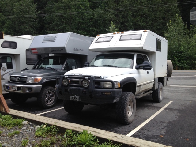
Another cool RV at the bear parking area. This is a bimobile camper on a diesel land cruiser.
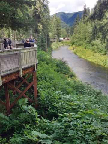
A look back at the camper (white dot) from the bear viewing platform. Yes, kind of touristy and cheesy but at least they are wild bears just doing their thing.

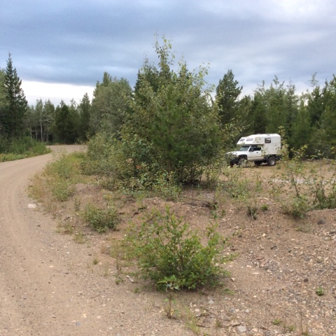
Day 29 Cost 129 Fuel Canadian and 25 for subway. Mosquito wars, 5 kills and 2 bites. Driving day. Spent some time this morning making an exit strategy. Had to give notice to folks that we were coming back, not coming that way etc. I typed up many emails to hopefully send out from the Stewart grocery store. Luckily they did go out when we got there. The rough plan is to get Mom a flight out of Seattle on the 28th. Drove about 400 miles today. The landscape is much nicer than on the way in. Many farms with rolling green grass. Had lunch at some first nation (their word for indian or native peoples) fishing area where they were taking salmon with big nets. At the town of Fraser river we broke down to temptation and stopped at subway for Linner. It was a nice treat. We saw a black bear with two cubs soon after. The animal life on this trip has been exactly what I was hoping for. Who would have thought we could see cubs, mooslings, caribeens, and goslings, or maybe they were swaslings. What is the name for a baby swan anyway. Mom just reminded me we also saw buffalings, eaglings, and wolflings. I believe we have seen the ling of every species. Camp map
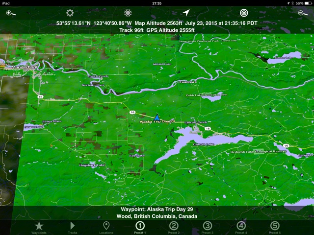
Campsite
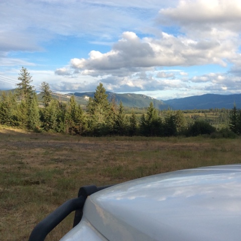
Campsite Day 30 Cost 117 Fuel canadian and 78 for groceries Mosquito wars, 3 kills and one bite Another early start to a solid driving day. First into Prince George for some groceries and fuel. I tried to use the internet there too, but it didn’t work much. Stopped for lunch around 150 mile house by a lake and scarfed the second half of our subway feast. Motored on down the road into Williams Lake where we found excellent internet at Tim Hortons. I was able to buy Mom’s plane tickets and reserve a spot at an RV park in Mt. Vernon, WA. We turned on Hwy 99 towards Whistler and started looking for camp. It’s funny, for some reason Mom always wants to stop for the night. Anywhere will do for her, she just wants to stop. We always have this minor tussle where I want to go see what’s around the next corner and she wants to park it. We found a dirt road and passed many corners until we were ten miles up and on top of the mountain. No, the camp area wasn’t much different from the ones closer to the highway but we did get to see what was around many corners. Camp map
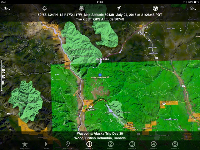
Campsite
Day 31 Cost 99 for fuel. Mosquito wars, 0 kills and 0 bites. Finally out of mosquito country yay! We got moving early again because it should be a big day. We hit our record low last night of 46. Yes, that’s including the whole trip. Very surprising to us how warm it was overall. The drive back down the mountain was quick. Funny how it always seems faster coming back out of the exploring areas. The road from Cache Creek to Squamish is a good one. It really winds and climbs in the beginning but levels as you go west. Soon after we left our camp site which was 20 miles out of the way, we found several places just up the road along the river that would have been nice. But hey, if we’d done that we wouldn’t have been able to marvel at the size of cow pies we found at our original site. We blew through Whistler and on to Squamish where we found another Tim Hortons for wifi and Mom’s coffee. Had to make some final arrangements for Mom’s trip home. From there we went to Big Chief so I could do a quick hike up the back side. It’s a hike to the top of the rock you can see from town. Only 3 miles round trip, but 1000 feet up. It hurt me way more than it should have. Apparently driving does not maintain ones fitness level. From the chief we went to my daughters house in Surrey. No camp map or camp picture because it’s her house. Alaska trip summary and comments. Fuel costs $1540 US, the exploremoremobile averaged 15mpg. Food $703 US, more than anticipated, food is expensive but we also ate well in the camper. All extras including eating out, entertainment, water pump, etc. $366 US This is where we tried to save the most. Mom also probably spent another 40 or so on her coffees and waters. Total trip cost $2609 US dollars. And the mosquito war totals, I know you have all been waiting for it. We were bitten 84 times, but were able to kill 366 of the buggers. So what did we think about the trip. I have to admit that for the first few days we were thinking maybe we’d made a big mistake. Our lowest point may have been turning around on the North Canol road. It just wasn’t what we were expecting. From that point forward there were still a few doubts, but spirits were up and we were happy to be there. Looking back we are both very happy to have made the journey. Some favorites were the Dempster, Denali highway, everything south of Anchorage in Alaska especialy Valdez and Hyder. The animal viewing was exceptional. A large part of any trip for me is what critters I see. On this adventure I saw more bear and moose than I’d seen in my entire life to date. The wolves, caribou, seals, marmots, were all just icing on the cake. I knew this trip wouldn’t have a lot of off roading opportunities. Still, it surprised me just how unaccessible the land is. We managed to get off the road a few times, but for the most part this is a scenic drive. I hate to admit it, but the perfect vehicle for the trip would be a sprinter camper van. No four wheel drive required. Am I happy that I went, definitely. Although tons of driving it’s totally worth it for what you get to see. Would I do it again, doubtful but maybe. I may come back some day with a backpack. As I said in a post, that would be the way to see Denali. I’m not good at sitting still for a month. If I was a kayaker, or fisherman this trip would have been so much better. My only real option to get out there and move was to hike and it was difficult to do because of being solo in bear country, weather, and not wanting to leave Mom alone for long periods So I say to you, do it, just be prepared to get your plump on.
